Archives des étiquettes pour : randonnée

hawks near Montreal

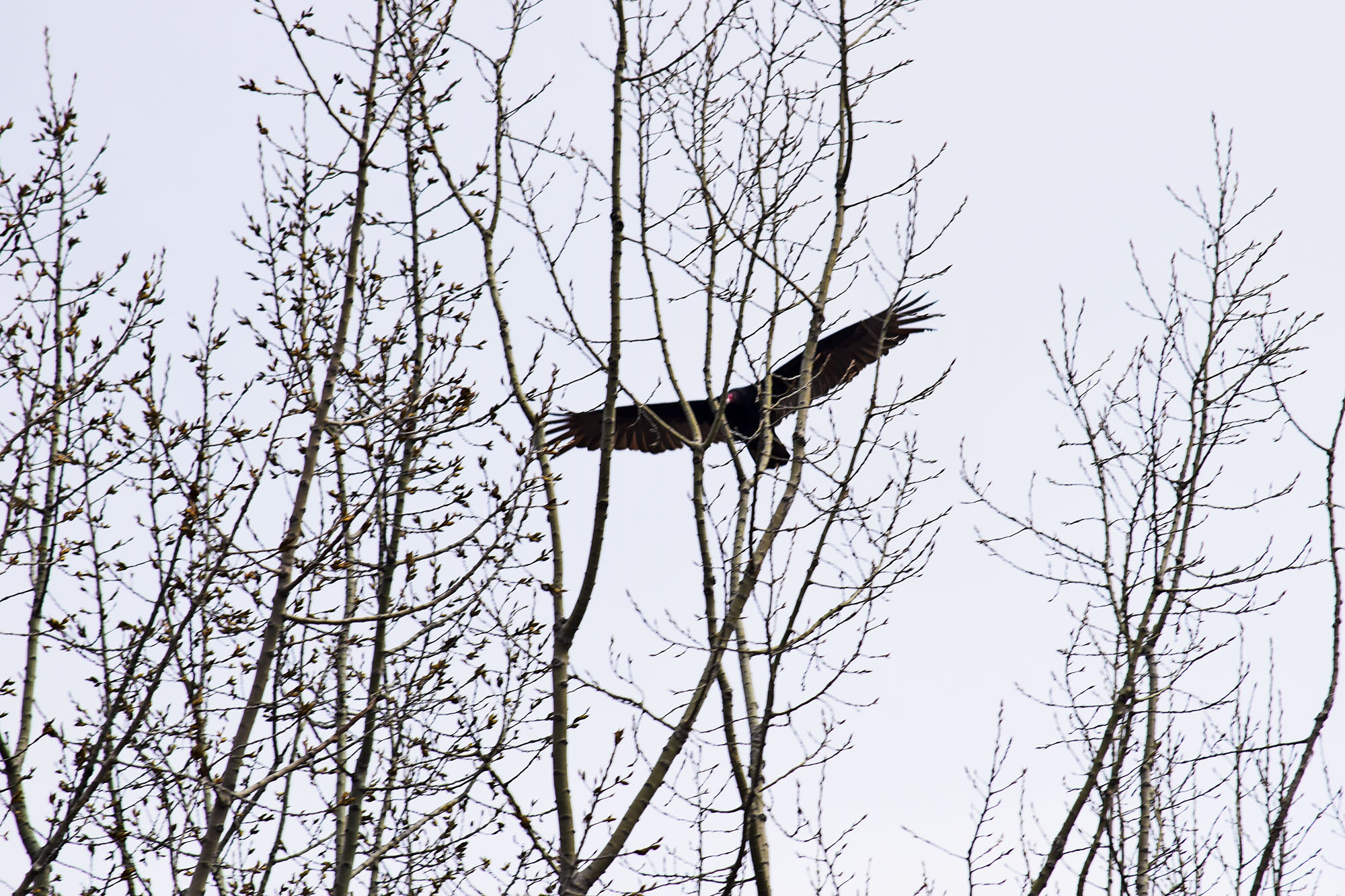
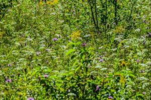
Montreal isn’t typically thought of as a wildlife destination, but there are surprising amounts of wildlife visible in and just outside the city — from great blue herons in the Lachine Rapids to white-tailed deer on the West Island, beavers in the marshes, and even moose within a 2-hour drive. Here’s where to go to actually see wildlife near Montreal in 2026.
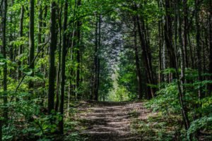
In-City Wildlife

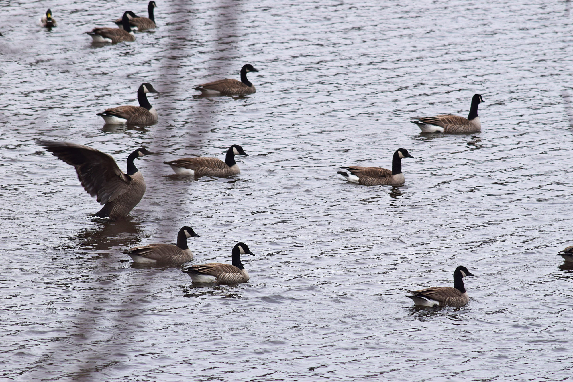
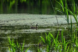
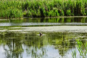
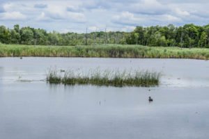
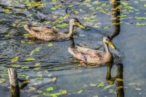
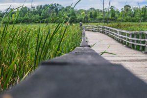
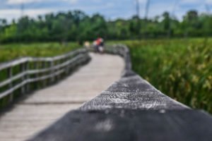
  • Parc des Rapides (LaSalle): Best in-city birding. Great blue herons, cormorants, gulls and migrating waterfowl year-round.
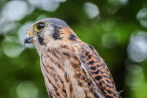
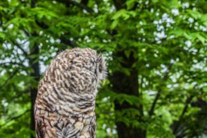
  • Mount Royal: Red foxes, raccoons, woodpeckers, owls (rare). Early morning best.
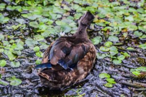
  • Botanical Garden / Parc Maisonneuve: Migrating warblers in spring, ducks year-round.
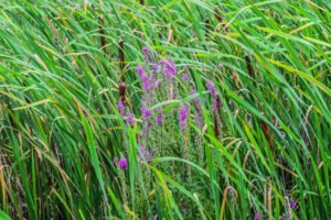
  • Parc Angrignon: Ducks, herons, and the only beaver colony inside Montreal’s metro area.

West Island Wildlife

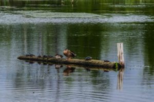
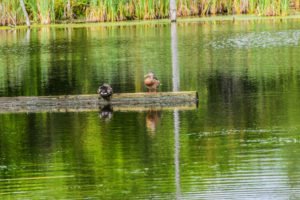
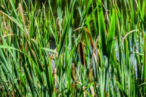
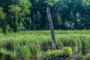
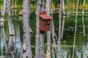
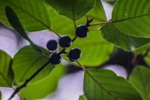
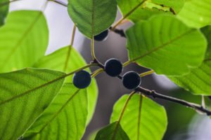
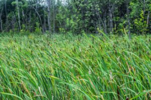
  • Bois-de-l’Île-Bizard Nature Park: Painted and snapping turtles, beavers, deer, herons in the marsh.
  • Cap-Saint-Jacques Nature Park: Deer, foxes, raccoons, and migrating birds.
  • Bois-de-la-Roche heritage farm-park: Deer at dawn/dusk, woodpeckers, owls.

South Shore

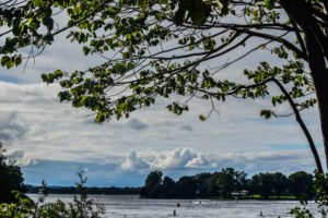
  • Parc national des Îles-de-Boucherville: Deer, beavers, foxes, migrating ducks. The closest SÉPAQ park.
  • Mont Saint-Bruno: Deer, lake birds, woodpeckers.

For Bigger Wildlife (1–3 Hours Away)

  • La Mauricie National Park: Moose, black bear, beavers, loons.
  • Jacques-Cartier National Park: Moose along the river, occasional black bear.
  • Gaspésie National Park (10 hours): Quebec’s southernmost woodland caribou herd.
  • Tadoussac (5 hours): Whale watching including beluga, fin and humpback whales.

Wildlife Viewing Tips

  • Dawn and dusk are best — animals are most active.
  • Bring binoculars or a zoom lens (300mm+).
  • Move slowly and quietly. Stop often.
  • Keep dogs on leash — they scare wildlife.
  • Never feed wildlife. It harms them and creates dangerous habituation.
  • Insect repellent April–September.

What to Pack

  • Binoculars (8×42 are versatile and affordable)
  • Camera with at least 300mm zoom (or smartphone with telephoto)
  • Field guide or eBird/Merlin app
  • Earth-tone clothing
  • Insect repellent

More Nature Guides

Mont Saint Hilaire Mountain Geese In the lake

Mont-Saint-Hilaire is the most-visited mountain near Montreal and the only one designated a UNESCO Biosphere Reserve. Located about 40 minutes east of the city, the Centre de la Nature offers 25 km of trails, a clear summit lake, and the famous “Pain de Sucre” peak with panoramic views all the way back to Montreal. Here’s the complete guide for visiting in 2026.

Why Mont-Saint-Hilaire

It’s close (40 min from downtown), it’s a real hike (300+ m elevation gain), and it has the best summit view of any easy mountain near the city — you can see the Montreal skyline, the Saint Lawrence River, and the Monteregian Hills in one panorama. The reserve protects rare old-growth forest, and there is always wildlife: deer, foxes, owls, woodpeckers.

Comment s'y rendre

  • En voiture: Highway 20 East to exit 113, then follow signs to Centre de la Nature (Chemin des Moulins). About 40 minutes from downtown Montreal.
  • Transports en commun : Train Exo line to Mont-Saint-Hilaire station, then taxi or rideshare (no direct bus to the trailhead).
  • Parking: Reservations now required for weekends and most summer days — book through the Centre de la Nature website.

Sentiers

  • Pain de Sucre (3 km return): The classic climb to the iconic summit. Steep with some scrambles near the top. 1.5–2 hours. Best panorama.
  • Dieppe Trail (4 km return): Easier alternative summit. Gradual climb, family-friendly.
  • Burned Hill (Sommet Brûlé) (6 km return): Quieter, panoramic.
  • Lake Loop (1.5 km): Flat loop around the summit lake. Stroller-accessible.

Total trail network: about 25 km of well-marked paths.

Informations pratiques

  • Frais d'entrée : ~$10 adult, ~$5 child (2026). Free for children under 6.
  • Heures: Open daily 8 AM–6 PM (winter hours vary).
  • Installations: Welcome centre, washrooms, picnic tables, small café, gift shop.
  • Chiens : Not allowed on trails (strict rule due to wildlife protection).
  • Réservations : Required for weekends — capacity is limited.

Meilleure période pour visiter

  • Weekdays in any season: Quietest, easiest to reserve.
  • Fin septembre – mi-octobre : Peak fall colours, the best photography window.
  • Hiver: Open for hiking and snowshoeing. Crampons recommended.
  • Éviter: Sunday afternoons in summer and fall — parking fills by 10 AM.

Que faut-il apporter ?

  • Proper hiking shoes — Pain de Sucre has loose rocky sections
  • 2 L of water per person
  • Snacks for the summit
  • Layers — summit is windier and cooler
  • Sunscreen, hat, insect repellent in summer
  • Camera with wide-angle for the panorama

Que combiner avec la randonnée

  • Saint-Hilaire orchards: Apple picking in September–October, just down the mountain.
  • Mont-Saint-Hilaire village: Charming with cafés and restaurants for a post-hike meal.
  • Cidrerie Michel Jodoin: Cider tasting nearby.
  • Beloeil: Pretty riverside town for a scenic detour.

FAQ: Mont-Saint-Hilaire

Do I really need a reservation?
For weekends yes, especially in fall. Weekdays are usually walk-in friendly.

Is the Pain de Sucre suitable for kids?
For kids 8+ with good shoes, yes. Younger kids should do the Dieppe Trail or Lake Loop.

How long is the hike?
Pain de Sucre takes most people 1.5–2 hours round trip; the longer loops 3–4 hours.

Photos of Mont-Saint-Hilaire

Summit views toward Montreal, the protected old-growth forest, and the year-round summit lake.

More Hiking Near Montreal

Bois-de-l'Île-Bizard Nature Park: Complete Guide to Hiking, Biking Wi — image 17

Parc-nature du Bois-de-l'Île-Bizard is one of the most underrated green spaces on Montreal’s West Island. Spread across the northern tip of Île Bizard, this Réseau des Grands Parcs nature park combines marshlands, mature forests, sandy beaches, and over 12 km of trails — yet it stays remarkably quiet even on summer weekends. If you want a peaceful day of hiking, biking, birdwatching, or even a swim, this is the closest “real nature” you can reach from downtown Montreal without leaving the island.

Where It Is and Why It’s Worth the Drive

The park sits on the north-west tip of Île Bizard, about 30 to 40 minutes from downtown Montreal by car. Unlike Mount Royal or Jean-Drapeau, you’ll find few tourists here — most visitors are West Island residents, birdwatchers, and families. The combination of forest, marsh, river views, and a small beach in one compact park is unique in greater Montreal.

Comment s'y rendre depuis Montréal

  • En voiture: Take Highway 40 West, exit at Boulevard Saint-Charles, then follow signs to Île Bizard via Pont Jacques-Bizard. Approximately 35 minutes from downtown.
  • Transports en commun : Metro to Côte-Vertu, then STM bus 470 + 207 to Île Bizard village, plus a 25-minute walk or short rideshare to the park entrance. Allow 90 minutes door-to-door.
  • À vélo : Possible via the West Island bike network and Route Verte, but it’s a long ride (35+ km from downtown).

Trails: 12+ KM of Hiking and Walking

The park features over 12 kilometres of trails, mostly flat and well-maintained:

  • The Marsh Trail (Sentier des Marais): A 2.5 km loop with a long wooden boardwalk over the wetlands — best spot for birdwatching and the most photogenic walk in the park.
  • The Forest Loop: A 4 km trail through mature maple and oak forest, mostly shaded, great in summer heat.
  • The River Trail: Follows the shore of Rivière des Prairies with regular viewpoints.
  • Connections to the beach: A short trail leads to the small sandy beach, supervised in summer.

Biking the Paved Path

There is a flat paved bike path running through the park that connects to the wider Île Bizard cycling network. It’s family-friendly, with no major hills, making it perfect for a beginner outing. Bring your own bike — there are no rentals on site.

Wildlife: One of Montreal’s Best Birdwatching Spots

The marshlands attract a remarkable variety of species:

  • Great blue herons, great egrets, and green herons in the marshes
  • Painted turtles and snapping turtles sunning on logs
  • Beavers and muskrats — easiest to spot at dawn and dusk
  • White-tailed deer in the forest sections
  • Migrating waterfowl in spring and fall

Bring binoculars or a zoom lens. The marsh boardwalk has several viewing platforms that work well for photography.

The Beach

The small Plage du Parc-nature du Bois-de-l’Île-Bizard is open in summer (typically late June to mid-August), with lifeguards on weekends. It’s a sandy beach on the Rivière des Prairies — perfect for a swim after a hike. Bring your own snacks; there is a small concession on site but limited options.

Informations pratiques

  • Entrance fee: Free entry to the park; parking is paid in summer (around $9/day in 2026) and free off-season. Free with the annual Grands Parcs pass.
  • Heures: Open daily, generally 6 AM to sunset.
  • Installations: Washrooms, picnic tables, BBQ areas, drinking water, small concession in summer.
  • Chiens : Allowed on leash on most trails, except on the beach.
  • Accessibilité: Main trails and the boardwalk are wheelchair accessible.

Meilleure saison pour visiter

  • Late May to early June: Wildflowers, returning birds, fewer mosquitoes.
  • July and August: Beach season, but bring strong insect repellent for the marsh.
  • Late September to mid-October: Peak fall colours, fewer crowds, great light for photos.
  • Hiver: Cross-country skiing on groomed trails, snowshoeing in the forest sections.

Que faut-il apporter ?

  • Sturdy walking shoes (sandals are fine for the boardwalk only)
  • Insect repellent (essential April to September, the marsh has mosquitoes)
  • Crème solaire et chapeau
  • 1 to 2 L of water per person
  • Binoculars or a zoom camera lens for birding
  • Swimsuit and towel in summer
  • Picnic supplies

Que combiner avec votre visite

  • Vineyards and orchards in Senneville and Sainte-Geneviève — several West Island producers are open for visits.
  • Île-Bizard village — charming with a few restaurants for a post-hike meal.
  • Bois-de-la-Roche heritage farm-park — another peaceful West Island park, 15 minutes away.
  • Ferry to Laval — a small seasonal cable ferry connects Île Bizard to Laval-sur-le-Lac.

Photos from Bois-de-l’Île-Bizard Nature Park

Plus de parcs près de Montréal

reflection of sky on water la mauricie national park

Parc national de la Mauricie is a Parks Canada wilderness destination roughly two hours north of Montreal, in the Mauricie region. Covering 536 km² of Canadian Shield forest, glacial lakes, and dramatic granite outcrops, it’s one of the best places near Montreal for a real wilderness day trip or multi-day camping adventure. This is the complete 2026 guide: trails, lakes, drive, fees, and what to combine with the visit.

Why La Mauricie Is Worth the Drive

Unlike day-trip parks closer to Montreal, La Mauricie feels remote. You’ll find moose, black bears, beavers, and over 150 lakes inside the park boundary. The famous Promenade scenic drive crosses the whole park with viewpoints over the lakes, and several short trails connect to longer wilderness routes. Fall colours here are among the most spectacular in eastern Canada.

Comment s'y rendre depuis Montréal

Take Highway 40 East to exit 217, then follow Route 351 North to Saint-Mathieu-du-Parc or Saint-Jean-des-Piles entrances. Drive time is approximately 2 hours from downtown Montreal. There is no direct public transit — a car or rental is essential.

Les meilleures randonnées

  • Les Cascades (5.4 km loop): Easy family hike past waterfalls. ~2 hours.
  • Lac Solitaire (6 km out-and-back): Forest hike to a hidden lake. ~3 hours.
  • Le Deux-Criques (14 km loop): Intermediate full-day hike with panoramic viewpoints over the park.
  • Laurentian Trail (75 km): Multi-day backpacking route across the park. Requires permits.

Lakes and Paddling

Canoe and kayak rentals are available at Lac Wapizagonke and Lac Édouard. Both lakes are stunning — Wapizagonke has the iconic narrow channel framed by granite cliffs that appears on most Mauricie postcards. Paddle for a day or arrange a multi-day canoe-camping trip.

Camping

  • Frontcountry campgrounds: Mistagance, Wapizagonke, Rivière-à-la-Pêche
  • oTENTik ready-to-camp tents: for families without gear
  • Backcountry camping: on the Laurentian Trail and along several lakes

Reserve through the Parks Canada reservation system — campsites fill fast for summer weekends.

Meilleure saison pour visiter

  • Late May–June: Wildflowers, no mosquitoes yet, fewer crowds.
  • Juillet-août : Peak swimming and paddling season. Bring strong bug spray for evenings.
  • Fin septembre – mi-octobre : The famous fall colours of the Canadian Shield. Hotels in the area book out — plan ahead.
  • Hiver: Snowshoeing on groomed trails, ice fishing on Wapizagonke.

Fees and Practical Info

  • Daily entry: ~$9.25 CAD adult, free for kids under 17.
  • Annual Parks Canada Discovery Pass covers entry to all Canadian national parks.
  • Installations: Visitor centres at both entrances, washrooms, drinking water, picnic areas, canoe rentals, small cafés.
  • Service cellulaire : Patchy throughout the park. Download offline maps before arriving.

Que combiner avec votre visite

  • Shawinigan and Cité de l’Énergie: Industrial heritage museum about 30 minutes away.
  • Trois-Rivières: Historic city for a stop on the drive back — riverside walks and great food.
  • Auberge Le Baluchon in Saint-Paulin: A spa retreat 30 min from the park for a relaxing finish.

FAQ: La Mauricie National Park

Do I need a reservation just to enter?
No, day-use entry doesn’t require reservation. Only camping does.

Is the park dog-friendly?
Yes, on leash. Some trails restrict dogs — check at the visitor centre.

How long should I plan to stay?
Minimum a full day. Two to three days lets you combine paddling, hiking, and one of the longer drives.

Photos of La Mauricie National Park

Canadian Shield landscapes, Wapizagonke channel, glacial lakes and fall colours.

Plus de parcs nationaux près de Montréal

MTL Fall time colors

De fin septembre à mi-octobre, le paysage québécois se pare de couleurs automnales parmi les plus spectaculaires d'Amérique du Nord. Des érables du mont Royal aux pentes orangées et rougeoyantes des Cantons-de-l'Est et des Laurentides, ce guide couvre l'ensemble de ce panorama. Les 10 meilleurs endroits pour admirer et photographier les couleurs d'automne près de Montréal en 2026, avec les horaires de pointe et comment y parvenir.

Calendrier des couleurs d'automne du Québec 2026

  • Mi-septembre à fin septembre : Les zones de plus haute altitude et les Laurentides au nord de Mont-Tremblant commencent à changer de couleur.
  • De la dernière semaine de septembre à la première semaine d'octobre : Sommets des Laurentides, sommets des Cantons-de-l'Est, Mauricie.
  • Mi-octobre : Pic de l'île de Montréal, Rive-Sud, basses altitudes.
  • Fin octobre : Couleurs finales, chute des feuilles.

10 Meilleurs Endroits

1. Mont Royal

Un classique. Les sentiers forestiers autour du Belvédère et du chalet sont à leur apogée à la mi-octobre. Le lever du soleil offre les plus belles photos.

2. Mont-Saint-Hilaire

Réserve de biosphère de l'UNESCO abritant une forêt d'érables ancienne. Apogée début octobre.

3. Parc national du Mont-Tremblant

Le site automnal le plus photographié du Québec. Apogée la dernière semaine de septembre.

4. Parc national de la Mauricie

La vallée de Wapizagonke et la route panoramique de la Promenade début octobre.

5. Mont Sutton (Cantons de l'Est)

Idéal pour les randonneurs — combinez l'ascension du sommet avec les couleurs automnales.

6. Parc national du Mont Orford

Lac Stukely + randonnées en montagne + couleurs des Cantons-de-l'Est.

7. Sentier des Caps de Charlevoix

À deux heures de route de Québec, mais cela vaut le détour pour la vue imprenable sur le Saint-Laurent depuis les falaises.

8. Parc Jean-Drapeau

Option facile en ville : les arbres le long de la rivière s'illuminent à la mi-octobre.

9. Parc national des Hautes-Gorges-de-la-Rivière-Malbaie

Le Grand Canyon du Québec. Pic de fin septembre.

10. Sentier de la Vallée du Diable (Mont-Tremblant)

Une partie moins connue de Tremblant, avec des sentiers plus tranquilles.

Les plus beaux itinéraires d'automne

  • Route 117 nord à travers les Laurentides
  • Route 132 le long du Saint-Laurent jusqu'à Charlevoix
  • Route des Sommets en Estrie
  • La Promenade de la Mauricie à l'intérieur du PN de la Mauricie

Conseils de photographie

  • Photographiez une heure après le lever du soleil et une heure avant son coucher pour obtenir la lumière la plus chaude.
  • Un filtre polarisant réduit le voile et sature les tons orange et rouge.
  • Les jours nuageux sont en fait parfaits : couleurs plus douces, pas de contraste d'ombre.
  • Utilisez la “ Carte des couleurs ” du gouvernement du Québec pour obtenir des mises à jour en direct sur les couleurs d'automne.

Plus de guides saisonniers